APRIL SMITH'S S.T.E.M. CLASS
  • HOME
  • STEM LABS
    • PRE-K STEM LABS
    • KINDERGARTEN STEM LABS
    • 1st GRADE STEM LABS
    • 2nd GRADE STEM LABS
    • 3rd GRADE STEM LABS
    • 4th GRADE STEM LABS
    • 5th GRADE STEM LABS
  • CAHABA ENGINEERS
    • LESSON 2
    • LESSON 3
    • LESSON 4
  • ABOUT OUR CLASS
  • PHOTO GALLERIES
    • PREK PHOTOS
    • KINDERGARTEN PHOTOS
    • 1ST GRADE PHOTOS
    • 2ND GRADE PHOTOS
    • 3RD GRADE PHOTOS
    • 4TH GRADE PHOTOS
    • 5TH GRADE PHOTOS
    • ENRICH PHOTOS
  • DATA BASES
    • DEBATE TOPICS DATABASE
    • AMERICAN BIOGRAPHIES
    • AMERICAN REVOLUTION
    • NON-FICTION RESEARCH
    • Animals
    • BIOMES
    • Native American Portal
    • NATIONAL PARKS
    • ALABAMA OUTDOORS
  • CONTACT ME
  • FUN LAB
  • STEM CHOICE BOARD
  • ACAP 2025
  • MULTI-CULTURAL CHRISTMAS
    • GERMANY LEARNING PAGE
    • GERMANY STEM ACTIVITIES
    • COLUMBIA LEARNING PAGE
    • COLUMBIA STEM ACTIVITIES


LESSON 12:
THE GEOGRAPHY OF THE WEST


FOCUS ACTIVITY
Lesson Mission

Picture
The Lesson Mission is what you (the student) will be able to do after the lesson is over.  
DIRECTIONS:  Begin today's entry by heading your paper with your name and the date and the Lesson Title.  Write down today's mission.

The Lesson Mission for today is to answer today's essential question:

Today, you will do your Lesson Chronicles slightly different.  I am going to give you a lesson packet.  Write the missions on the first page of the packet.  

Lesson Mission (1):  I can identify the regions of the West and describe their landscape and climate. 

Lesson Mission (2):  I can predict the reasons settlers moved to the West and the problems they faced. 


TEACHING ACTIVITY
Geography Interactive

Picture
DIRECTIONS:  In this activity, we will do an interactive map activity as a class.  Click on the map to the left to get started.  We will do this together in class.


WHOLE GROUP ACTIVITY
Guided Reading

Picture
DIRECTIONS:  Now that you have a purpose for reading, we will take turns reading the passage as a class.  Then we will discuss the questions below the passage to make sure everyone comprehends what we have read.

Geography of the West
The West
Ranges, deserts, and canyons are a few landforms you will find in the West Region. This last region in the United States has a variety of physical features. It is also our largest region. There are thirteen states in the West Region.
Picture
The West Region of the United States
Subregions
The United States Census Bureau divides the West into two subregions. They are the Pacific West and the Mountain West. 
Picture
The Subregions of the West Region
The Pacific West Region
The Pacific West includes California, Oregon, Washington, Alaska, and Hawaii. This subregion is very unique. Why? Well, Alaska and Hawaii do not touch any of the other 48 states. They don't even touch each other! Alaska's eastern border is the country Canada. Hawaii is located in the Pacific Ocean. It is a group of many islands. So, you could say Hawaii is not located on the continent of North America. The Pacific Ocean is the western border of California, Washington, and Oregon. 
Picture
The Pacific West Subregion
Picture
Alaska and Hawaii in relation to the Continental United States
The Mountain West Region
The Mountain West has eight states. They are Montana, Idaho, Wyoming, Nevada, Utah, Colorado, Arizona, and New Mexico. This subregion has the largest area of land. These eight states are also one-fourth of our country's land area. The fourth largest state, Montana, is in this region. 
Picture
The Mountain West Subregion
The Four Corners
Mountain West states are bordered by rivers and mountain ranges. However, these states also have straight lines or geometric borders. Arizona and New Mexico are separated by a geometric border. This straight line runs north. It also separates Utah and Colorado. These four states come together to meet at one point. This point is called the Four Corners. These are the only four states in the U.S. that meet at one point. If you visit the Four Corners, you will see a monument. You would also be able to stand in at least two states at one time. 
Picture
The Four Corners
The Pacific West and Mountain West have many physical features in common. Mountains, canyons, deserts, and plateaus are found in both regions. In the Mountain West, you have the Rocky Mountains. This mountain range goes from northern Canada and Alaska to Mexico. It is also our country's largest mountain range. The Rocky Mountains are higher than the Appalachians. If you want to visit its highest peak, you need to go to Colorado. That is where Mount Elbert is found. Its elevation is 14,433 feet high. 
Picture
Rocky Mountains
The Pacific West has the Coast Ranges and the Cascades. The Coast Ranges are found along the Pacific Coast. Our highest mountain is found in this range. It is Mount McKinley in Alaska. Its elevation is 20, 320 feet. The Coast Range stretches along the Pacific Coast. It also forms cliffs in many places. The Cascade Range is an inland mountain range. It is found in Washington, Oregon, and California. The Cascades almost run through the center of Washington and Oregon. Once you reach California, the range is called the Sierra Nevada. This is a Spanish name that means snowy range. Its highest peak is Mount Whitney. Mount Whitney has an elevation of 14,495 feet. 
Picture
The Cascades
The Pacific West has a special type of mountain. These are called volcanic mountains. Volcanoes are openings in the Earth's surface. Gas, steam, stones, ashes, and melted rock are forced through these openings. This melted rock is called lava. Volcano eruptions happen, but not often. There may be many years before a volcano erupts. This region has major volcanic mountains. One is Kilauea in Hawaii. The Hawaiian Islands were formed by volcanoes millions of years ago. These volcanoes are in the Pacific Ocean. Kilauea is on one of Hawaii's islands. Mount Saint Helens is located in Washington State. Its last major eruption happened on May 18, 1980. This eruption destroyed trees; melted ice and snow on the mountain; and caused landslides and floods. Animals were killed and some people also lost their lives. It has taken time, but plants and animals have returned to Mount Saint Helens. 
Picture
Volcanic Mountains of Hawaii
Moving away from the mountains, you find canyons, valleys, and basins. In the Mountain West, there is the Great Basin. This broad, flat valley is in most of Nevada and Utah. This flat land is surrounded by the Rocky Mountains to its east. Its western border is the Sierra Nevada Mountains. The Grand Canyon is one of our country's most popular landforms. It was formed by the Colorado River millions of years ago. The Grand Canyon is found in northwestern Arizona. It is one of the canyons that is found in the Colorado Plateau. This is our country's largest plateau. If you were to visit the Grand Canyon, you would see mesas and buttes. Mesas are high, wide, flat mountains that are smaller than plateaus. They have steep rock walls. Buttes are single, flat-topped hills. The land that surrounds them is level or flat. Buttes also have steep rock walls. 
Picture
The Grand Canyon
There are quite a few valleys in the Pacific West Region. They are found between the Coast Ranges and the Sierra Nevadas. The Cascade Range is also to the east of these valleys. In California there is the San Joaquin Valley. The largest valley in the Pacific West is the Central Valley. This valley is 60 miles wide and 400 miles long. Sacramento, the capital of California, is found in this valley. In Oregon, there is the Willamette Valley. It is the second largest valley in the Pacific West. This valley is found in northwest Oregon. In this valley is the Willamette River. It joins the Columbia River. Portland and Salem are located in this valley. Salem is the capital of Oregon. One valley is located in southern California. It is north of the Mojave Desert. This valley is called Death Valley. Death Valley is one of the hottest and driest places in our country. It also has the lowest elevation in North America. Death Valley is 282 feet below sea level. In Geography of the West Region, Part 2, you will learn about deserts, rivers, and climate of the West Region. 
Picture
Mojave Desert

SMALL GROUP ACTIVITY
Mapping

Picture
DIRECTIONS:  Over the next few lessons, you will work on a geography project.  You will each make your very own, geography picture book that will go into your Lesson Chronicles.  You will each receive a photocopy of the packet embedded below.  You can find all the answers on this webpage.  


INDIVIDUAL ACTIVITY
Lesson Chronicles

Remember you will do the Geography Packet as your Lesson Chronicles Entries for Topic 6.

Picture
DIRECTIONS:  Make sure that you have put all of the mini-project pages into your lesson chronicles.  You will be graded on this mini-project.  It will be worth 100 points.

West Mini Project


HOMEWORK
Family Time

Picture

Remember, you have homework every night in Social Studies.  Your homework is to show your Lesson Chronicles to your family and tell them what you learned today.  Not only will this give you quality time with your family but it will help you review for your unit test.  Go over your lesson chronicles entry from today everyday to help you study for the Topic Quiz and Unit Test.

Picture
Picture

Lesson Toolbox

Picture

Words to Know

border:  a line separating one state or region from another

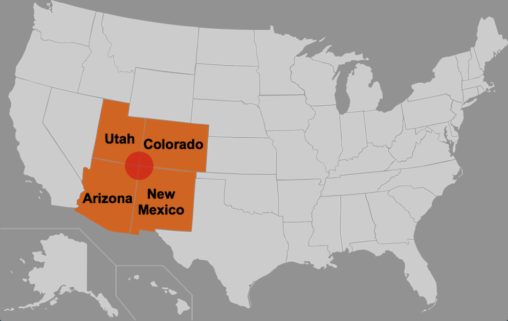
climate:  the usual weather conditions in a particular place or region

geometric regions:  regions that connect to each other by straight lines like the Four Corners States of Utah, Arizona, Colorado, and New Mexico

landform:  a natural feature of the Earth’s surface

physical features:  the types of landforms, bodies of water, climate, trees, plants, soil, and animals in a region


subregions:  regions within a larger region

Landforms to Know

basin:  a dip in the surface of the land or ocean floor
Picture
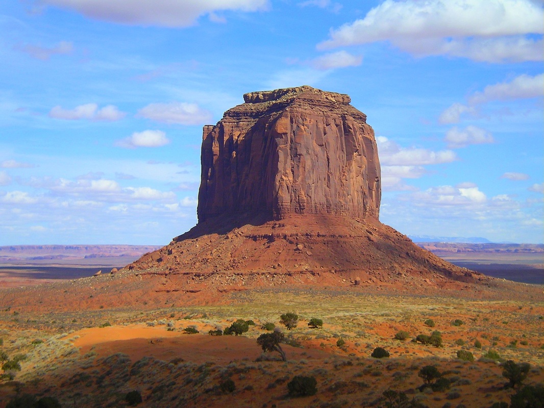
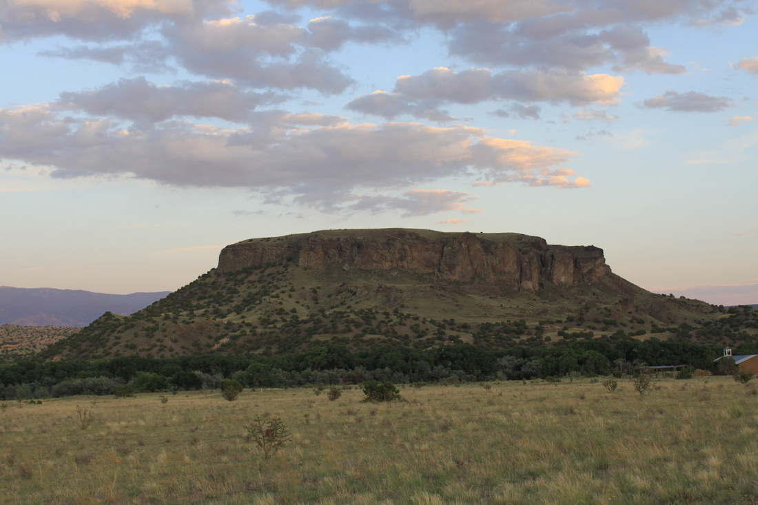
butte:  a single, flat-topped hill with steep rock walls and the land that surrounds it is level or flat 
Picture
canyon:  a deep valley with very steep sides - often carved from the Earth by a river
Picture
deserts: a very dry area that gets very little rain and has very few natural water sources
Picture
cliff:  a steep face of rock and soil 
Picture
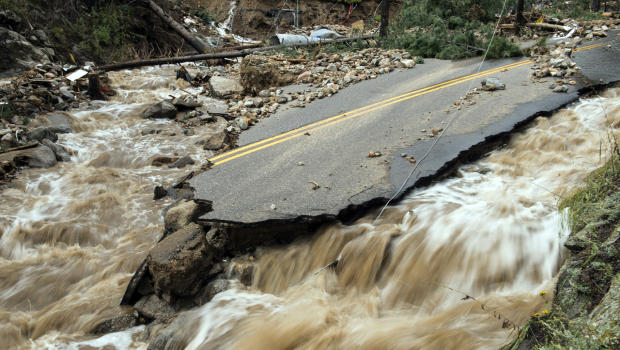
flood:  a large amount of water covering an area of land that is usually dry
Picture
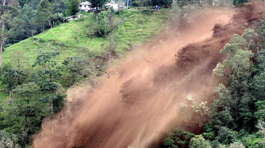
landslide: a large mass of rocks and earth that suddenly and quickly moves down the side of a mountain or hill
Picture
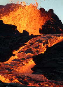
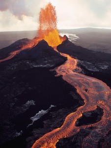
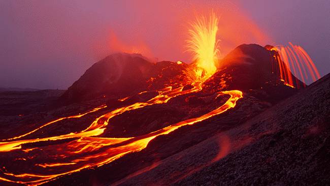
lava:  Earth's magma once it has broken the Earth's surface made up of gas, steam, stones, ashes, and melted rock 
Picture
mesa: high, wide, flat mountains with steep, rock walls that are smaller than plateaus
Picture
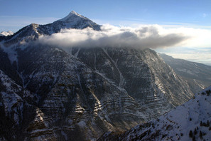
mountains:  a very tall high, natural place on Earth - higher than a hill
Picture
plateau:  large, flat area of land that is higher than the surrounding land
Picture
ranges: a chain of mountains and/or high elevations
Picture
river:  a large, flowing body of water that usually empties into a sea or ocean
Picture
sea level:  the level of the surface of the sea that is used to measure how high or low different land forms on Earth are
Picture
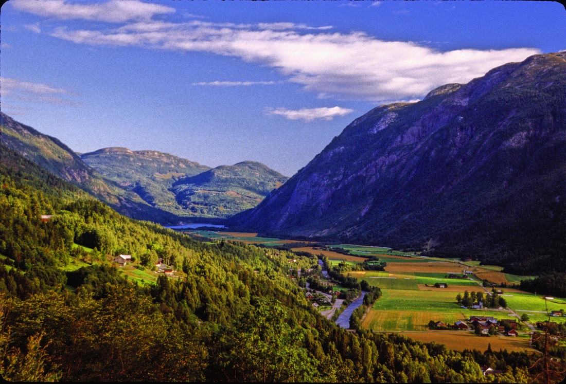
valley: a low, flat place between mountains
Picture
Volcano:  openings in the Earth's surface where lava is forced through 
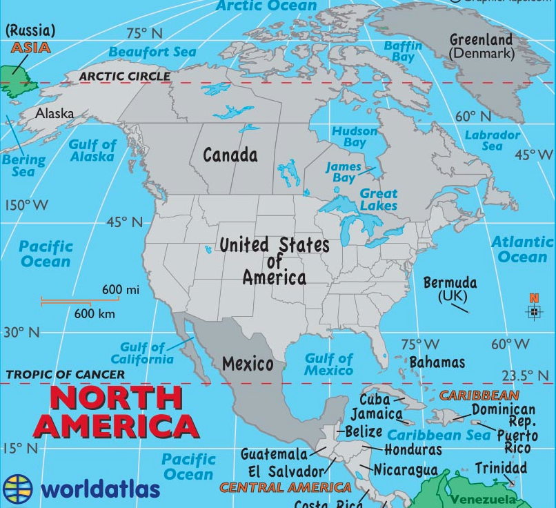
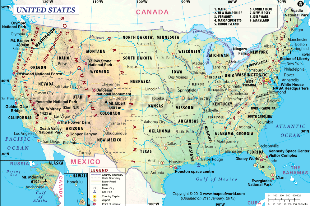
Picture

Places to Know

North America:  Continent in the western hemisphere made up of three large countries: the United States, Canada, and Mexico; the countries of Central America; the island of Greenland, and the islands in the Caribbean Sea
Picture
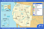
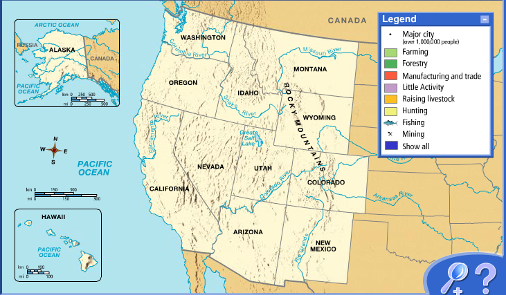
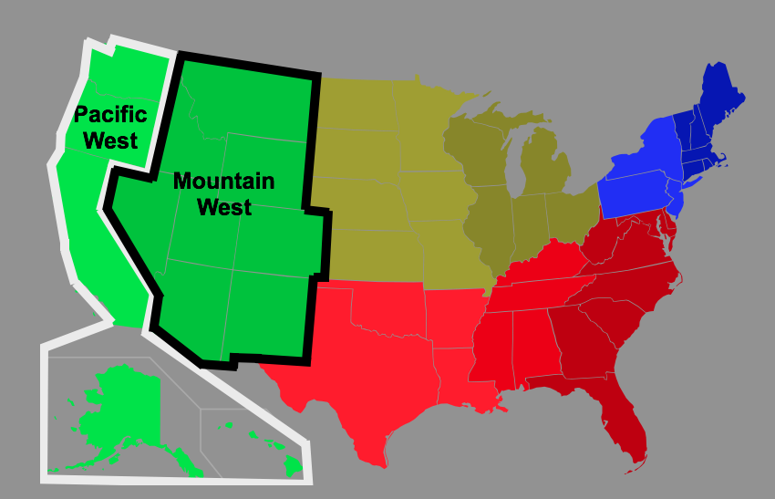
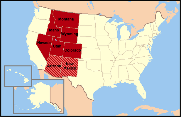
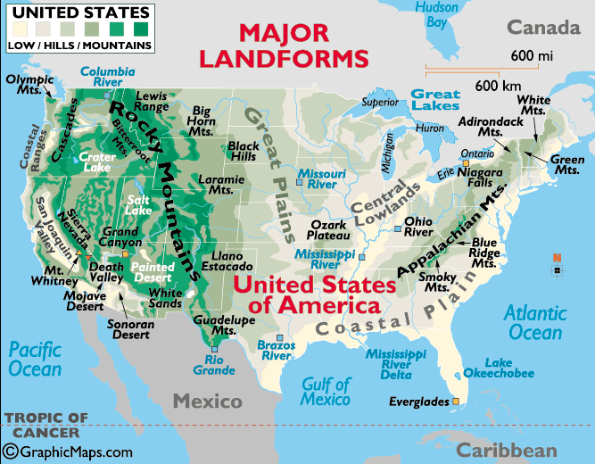
The American Western Region: the largest region in the United States with 13 states that contains many ranges, deserts, and canyons and is located in the western portion of the United States.
(States in Red Below)
Picture
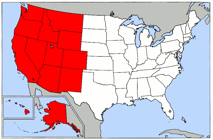
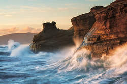
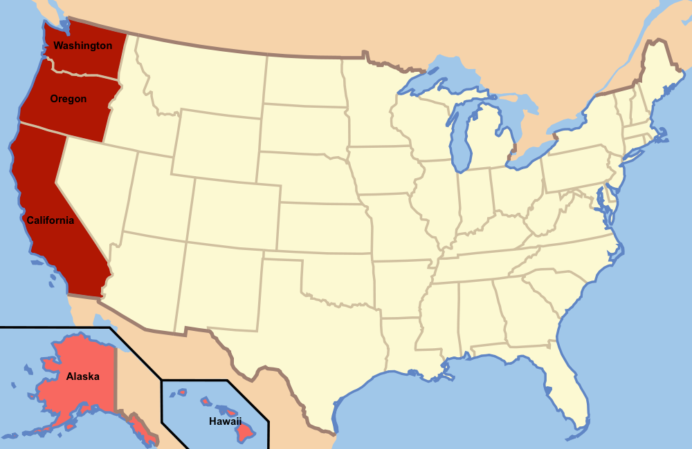
The Pacific West Region: the states of the U.S. that are the furthest to the West and border the Pacific Ocean including:  California, Oregon, Washington, Alaska, and Hawaii
(States in Red Below)
Picture
The Mountain West Region: the largest subregion in the United States with 8 states that contains many ranges, deserts, and canyons and is located between the Midwest Region and the Pacific Coast Subregion
(States in Red Below)
Picture
Four Corners States:  the states of Arizona, New Mexico, Colorado, and Utah that all four meet at one point
Picture
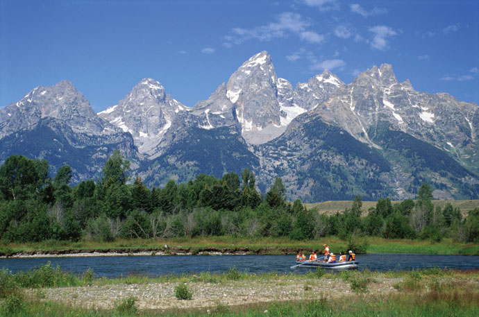
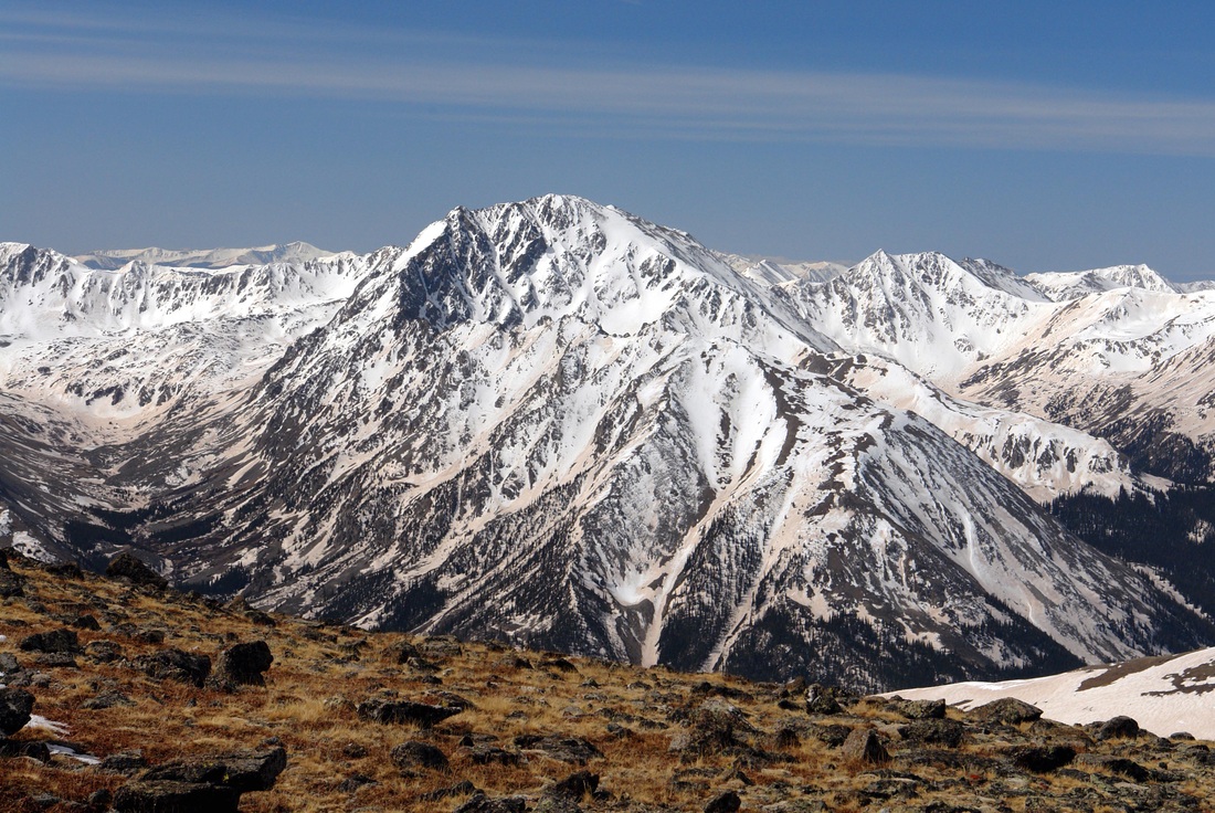
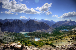
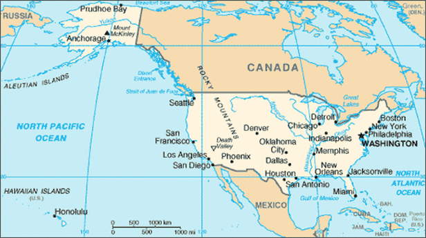
Rocky Mountains:  a mountain range in the Mountain West that goes from northern Canada and Alaska to Mexico and is our country's largest mountain range
Picture
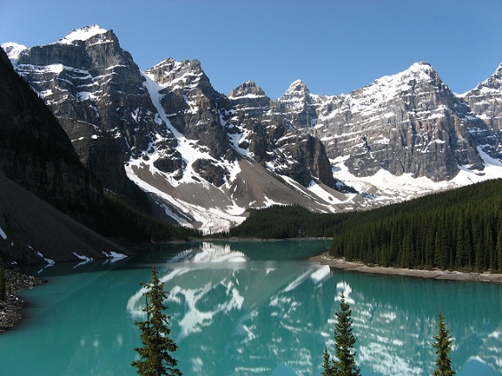
Mt. Elbert:  the mountain in Colorado that is the highest mountain in the Rocky Mountains
Picture
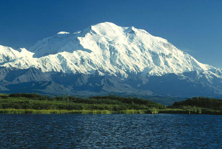
Pacific Coast Ranges:  Mountain range found along the Pacific Coast of the United States 
with many cliffs and containing the U.S.'s highest mountain, Mount McKinley in Alaska 
Picture
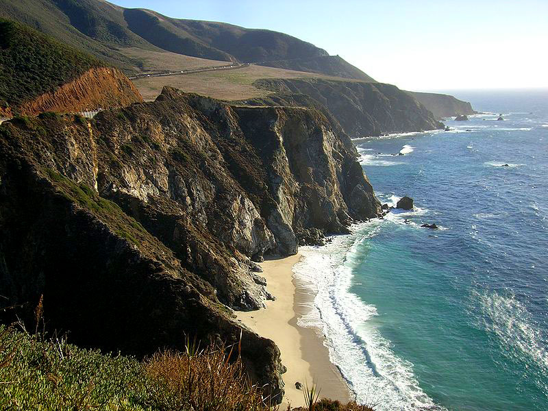
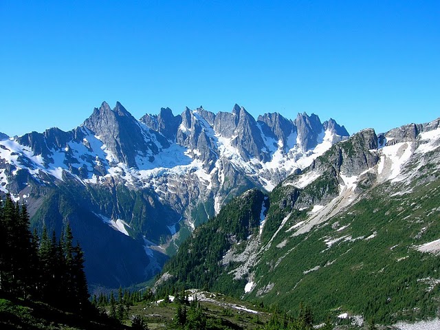
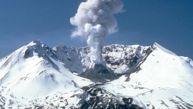
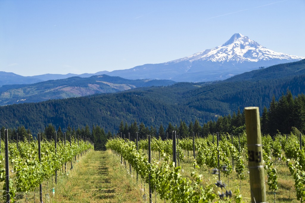
Cascades:  mountain range that is part of the Ring of Fire, a cluster of volcanic mountains in North America that begin in British Columbia in Canada and extend south through Washington and Oregon in the United States
Picture
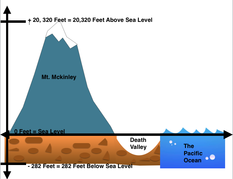
Mt. McKinley:  the U.S.'s tallest mountain in Alaska; part of the Pacific Coast Range
Picture
Mt. St. Helens:  a volcanic mountain of the Cascade Mountain Range located in Washington State that last erupted in 1980
Picture
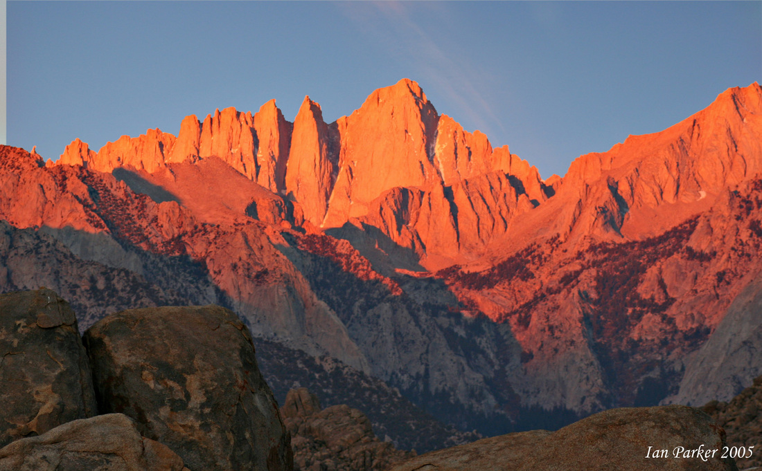
Sierra Nevadas:  the name of the Cascade mountains that run through California
Picture
Mt. Whitney:  the highest point of the Sierra Nevada Mountains
Picture
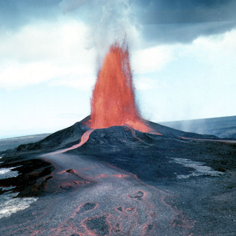
Kilauea: one of the most active volcanic mountains in the United States, located in Hawaii
Picture
Pacific Ocean:  body of salt water extending from the Antarctic region in the south to the Arctic circle in the north and lying between the continents of Asia and Australia on the west and North and South America on the east. It occupies about one-third of the surface of the earth and is the world's largest ocean
Picture

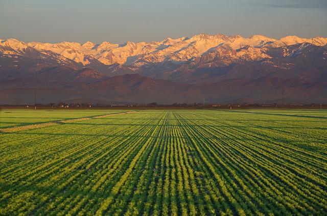
San Joaquin Valley: a major valley of the Pacific West Region located in California
Picture
Central Valley:  the Pacific West Region's largest valley located in California 
Picture
Willamette Valley:  the Pacific West Region's second largest valley located in Oregon 
Picture

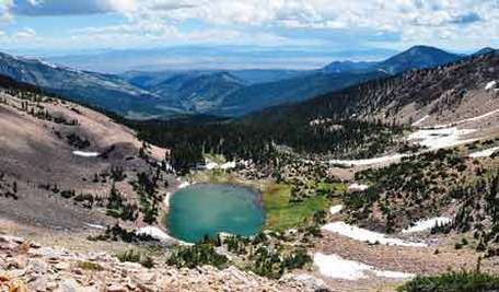
Great Basin: a basin in the Mountain West, mostly Utah and Nevada, that is a broad, flat valley surrounded by the Rocky Mountains to its east and the Sierra Nevada Mountains to the west
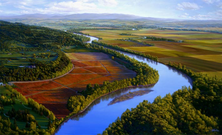
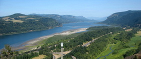
Willamette River:  a river found in Oregon in the Willamette Valley that connects to the Columbia River
Picture
Picture

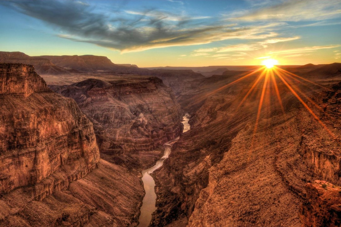
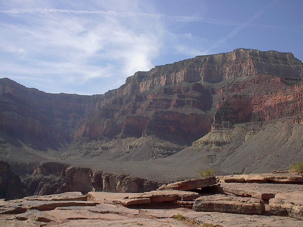
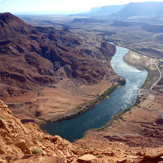
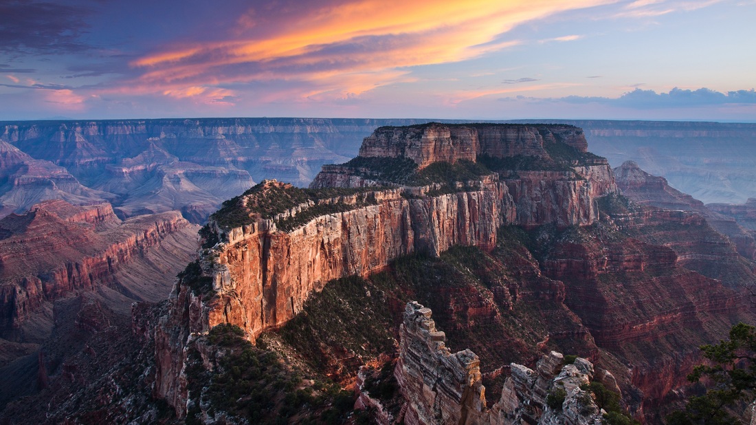
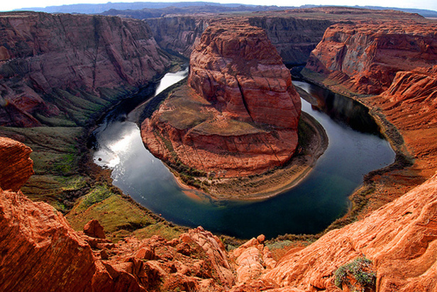
Colorado River:  the river in Northwestern Arizona that was responsible for forming the Grand Canyon
Picture
Picture
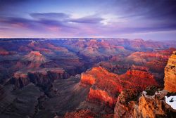
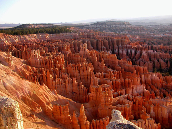
Grand Canyon:  a deep canyon in Northwestern Arizona with many buttes and mesas that was formed by the Colorado River 

Colorado Plateau:  the U.S.'s largest plateau range mostly in the Southwestern region of the U.S. that includes the Grand Canyon
Picture

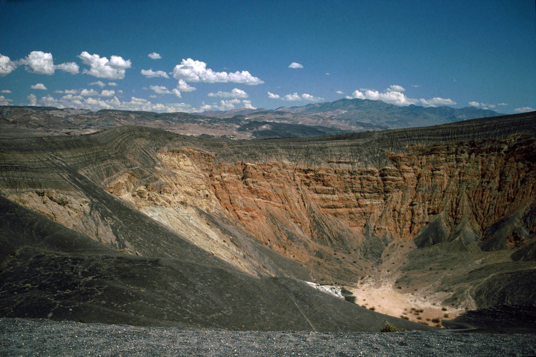
Death Valley:  valley located in southern California and north of the Mojave Desert; it is the hottest and driest place with the lowest elevation in North America at 282 feet below sea level
Picture
Columbia River:  the largest river in the Pacific West Region of North America
Picture
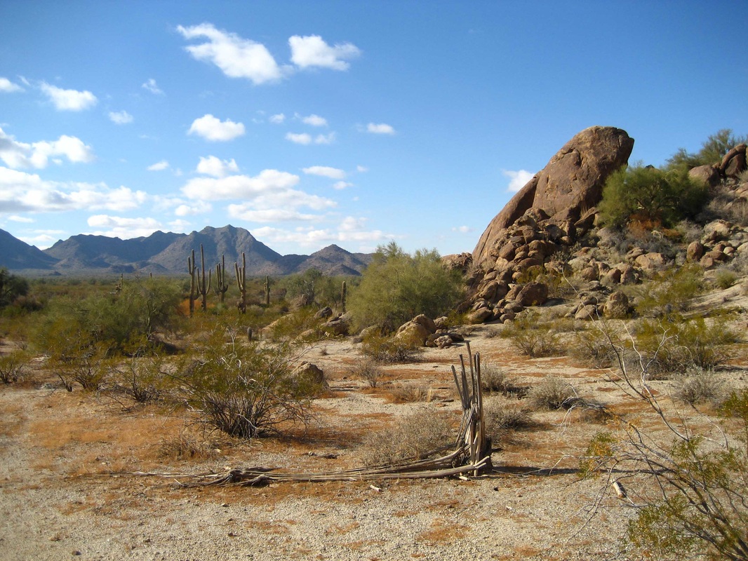
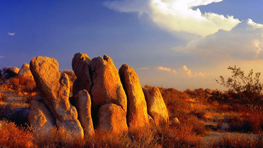
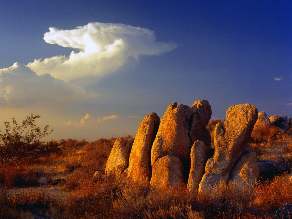
Mojave Desert:  U.S. desert located in parts of California, Utah, Nevada, and Arizona that contains basins and ranges
Picture

END OF LESSON 12 MODULE

Picture


Congratulations!  You have completed Lesson 12 Module!


  • HOME
  • STEM LABS
    • PRE-K STEM LABS
    • KINDERGARTEN STEM LABS
    • 1st GRADE STEM LABS
    • 2nd GRADE STEM LABS
    • 3rd GRADE STEM LABS
    • 4th GRADE STEM LABS
    • 5th GRADE STEM LABS
  • CAHABA ENGINEERS
    • LESSON 2
    • LESSON 3
    • LESSON 4
  • ABOUT OUR CLASS
  • PHOTO GALLERIES
    • PREK PHOTOS
    • KINDERGARTEN PHOTOS
    • 1ST GRADE PHOTOS
    • 2ND GRADE PHOTOS
    • 3RD GRADE PHOTOS
    • 4TH GRADE PHOTOS
    • 5TH GRADE PHOTOS
    • ENRICH PHOTOS
  • DATA BASES
    • DEBATE TOPICS DATABASE
    • AMERICAN BIOGRAPHIES
    • AMERICAN REVOLUTION
    • NON-FICTION RESEARCH
    • Animals
    • BIOMES
    • Native American Portal
    • NATIONAL PARKS
    • ALABAMA OUTDOORS
  • CONTACT ME
  • FUN LAB
  • STEM CHOICE BOARD
  • ACAP 2025
  • MULTI-CULTURAL CHRISTMAS
    • GERMANY LEARNING PAGE
    • GERMANY STEM ACTIVITIES
    • COLUMBIA LEARNING PAGE
    • COLUMBIA STEM ACTIVITIES