Unit 1: Geography, Government and Economics, Oh My!
LESSON 1:
POLITICAL MAPS
Topic 1: Geography 101
LESSON MISSION
Activity 1: Write the Lesson Mission Statements below in your Lesson Chronicles on the Lesson 1 Political Maps Page found under the header "Lesson Mission."

- I can define the term, "political map."
- I can identify the seven major continents and five major oceans.
- I can identify the major countries of each continent.
READ ABOUT IT!
Activity 2: Read the Lesson 1 Text below. Match the vocabulary words and their definitions in your Lesson Chronicles on the Lesson 1 Political Maps Page found under the header "Lesson Vocabulary."
What Does Political Mean Anyway?
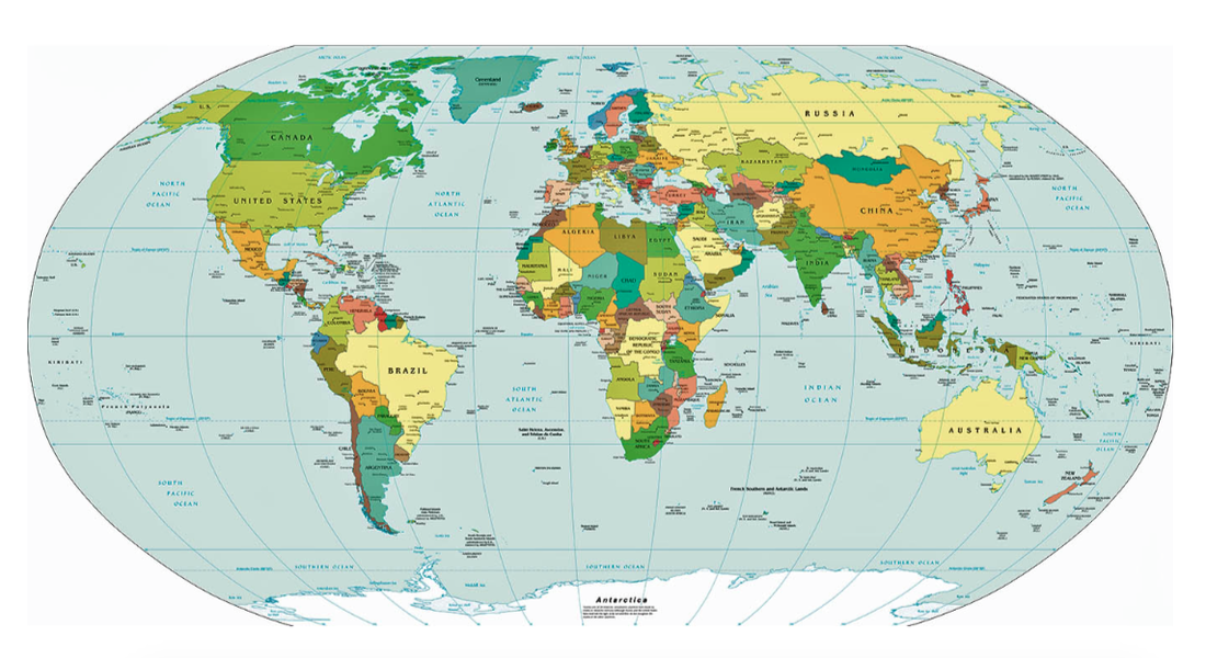
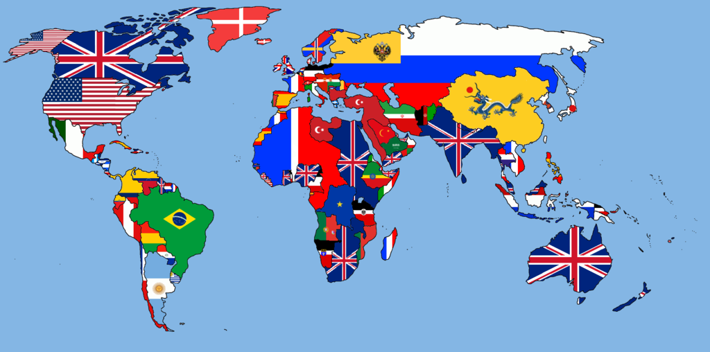
Politics can best be described as the way a government runs a nation or people's opinions about how a government should run a nation. So the word political refers to anything involving the government of a nation. You know what a map is! Well hopefully you do! So it makes sense that a political map is a map that shows the boundaries of governments including: countries, states, counties, and cities. It also includes significant bodies of water.
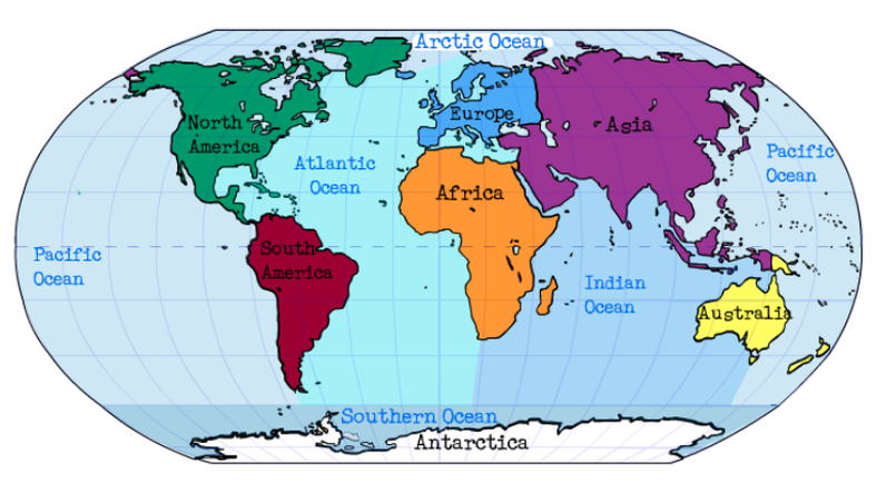
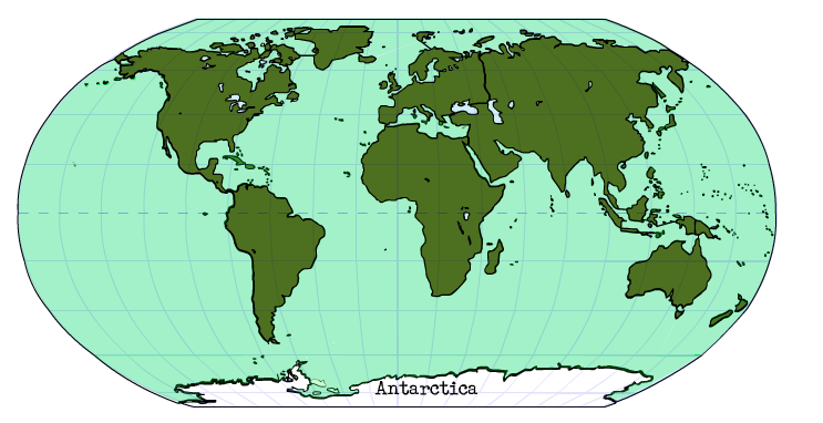
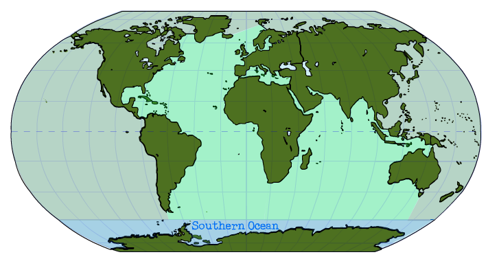
Continents and OceansA political map of the world begins with continents and oceans. Continents are the major land masses of Earth. There are 7 major continents: North America, South America, Europe, Asia, Africa, Australia, and Antarctica. There are 5 major oceans: The Atlantic Ocean, the Pacific Ocean, the Indian Ocean, the Arctic Ocean, and the Southern Ocean.
Major Countries and SeasEach continent has major countries within the continent. The maps below show the major countries in each continent.
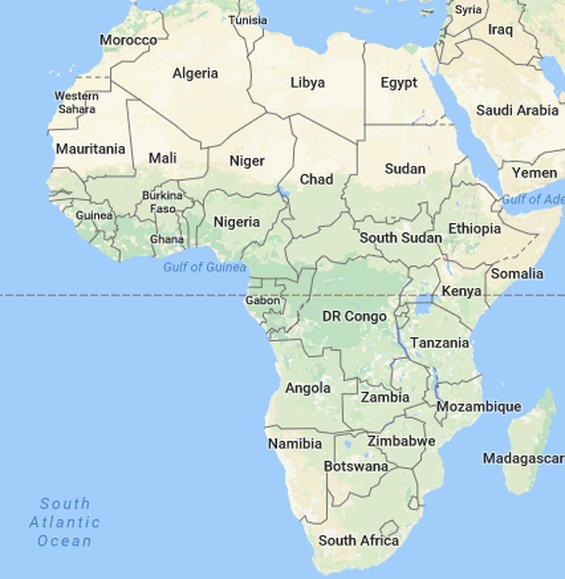
Africa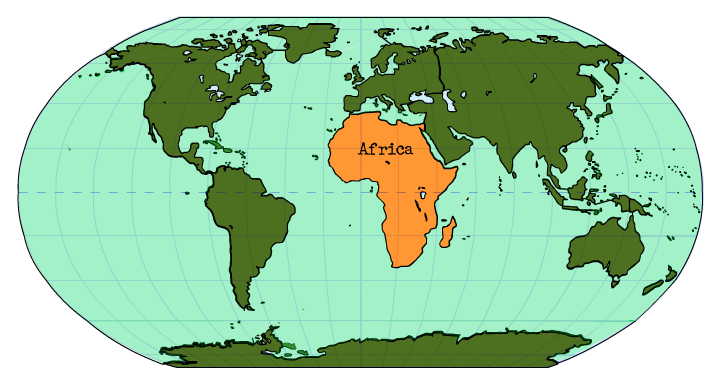
Africa is a continent that is divided by the equator. The equator is an imaginary circle around the earth, halfway between the north pole (the top of the Earth) and the south pole (the bottom of the Earth). Major countries in Africa are The Democratic Republic of Congo, Egypt, Ethiopia, Kenya, Madagascar, Morocco, Nigeria, Somalia, South Africa, and Sudan.
|
TOOL BOX
Terms in the tool box are listed in the order they appear in the reading.
politics: the way a government runs a nation or people's opinions about how a government should run a nation
political refers to anything involving the government of a nation. political map is a map that shows the boundaries of governments including: countries, states, counties, and cities. It also includes significant bodies of water. continents: the major land masses of Earth Africa: A continent that is divided in half by the equator and has the major countries of The Democratic Republic of Congo, Egypt, Ethiopia, Kenya, Madagascar, Morocco, Nigeria, Somalia, South Africa, and Sudan equator: an imaginary circle around the earth, halfway between the north pole and the south pole that divides the Earth into the Northern and Southern hemispheres Antarctica: the continent that surrounds the South Pole and has no major countries because it is the coldest place on Earth Asia: Earth's largest and most populous continent located in the eastern and northern hemispheres whose major countries are China, India, Indonesia, Pakistan, Russia, Japan, the Philippines, Vietnam, Iran, Thailand, North Korea, South Korea, Saudi Arabia, Nepal, Taiwan, and Israel hemisphere: a half of the earth, divided into northern and southern halves by the equator, or into western and eastern halves by the prime meridian prime meridian: an imaginary circle around the earth, from the north pole to the south pole that divides the Earth into the Eastern and Western hemispheres Australia: the smallest continent, between the Indian Ocean and the southwest Pacific Ocean and the only continent that is also a country Europe: the sixth smallest continent, surrounded by the Arctic Ocean to the North, the Atlantic Ocean to the East, and the Mediterranean Sea to the South that contains the countries of United Kingdom or Great Britain, France, Germany, Italy, Spain, Portugal, Ireland, Belgium, Norway, Sweden, and Finland North America: the third largest continent located entirely within the Northern Hemisphere and almost all within the Western Hemisphere containing the major countries of Canada, the United States, and Mexico South America: continent located entirely in the Western Hemisphere and mostly in the Southern Hemisphere that is linked to North America by the Isthmus of Panama and contains the major countries of Argentina, Brazil, Chile, Peru, Columbia, and Venezuela. Isthmus of Panama: a narrow strip of land that lies between the Caribbean Sea and the Pacific Ocean, linking North and South America |
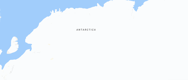
Antarctica
Antarctica is a continent that surrounds the South Pole. It is the coldest place on Earth and is completely covered by ice. It is so cold that very few people live there. There are no major countries in Antarctica.
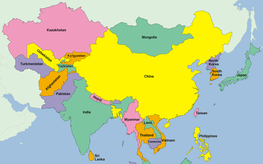
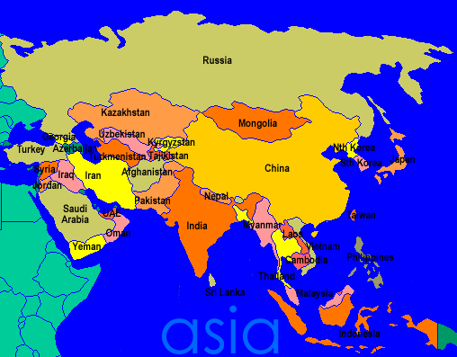
Asia
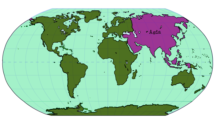
Asia is Earth's largest and most populous continent. It is mostly located in the eastern and northern hemispheres. A hemisphere is a half of the earth, divided into northern and southern halves by the equator, or into western and eastern halves by the prime meridian. The major countries of Asia are China, India, Indonesia, Pakistan, Russia, Japan, the Philippines, Vietnam, Iran, Thailand, North Korea, South Korea, Saudi Arabia, Nepal, Taiwan, and Israel.
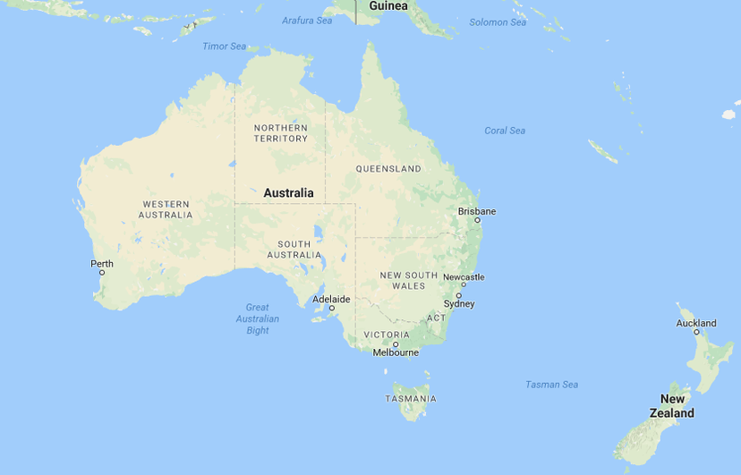
Australia
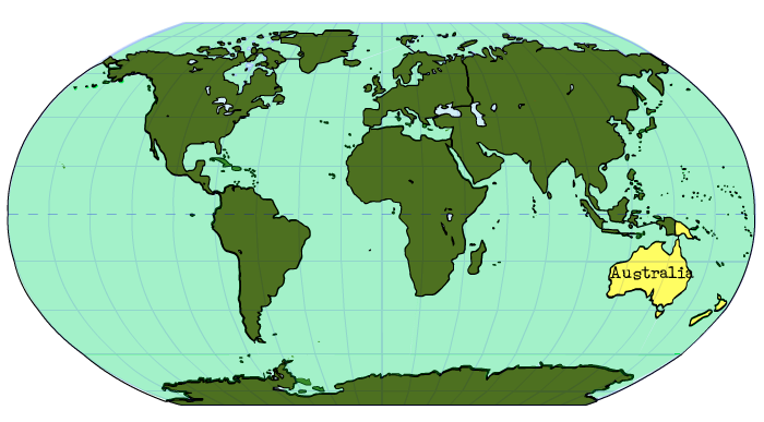
Australia is the smallest continent, between the Indian Ocean and the southwest Pacific Ocean. It is the only continent that is also a country. So Australia is the only place in the world that is a country and a continent.
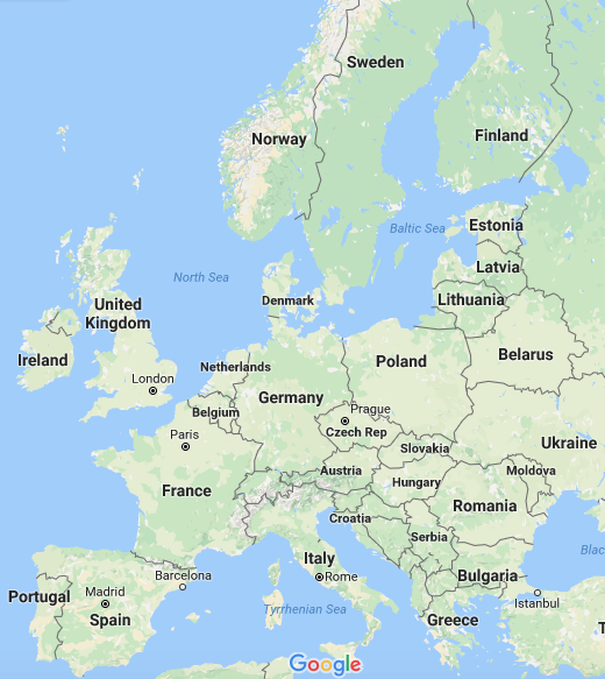
Europe
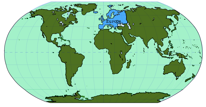
Europe is the sixth smallest continent. It is surrounded by the Arctic Ocean to the North, the Atlantic Ocean to the East, and the Mediterranean Sea to the South. The continent of Asia is on its eastern border. The major countries of Europe include: The United Kingdom or Great Britain, France, Germany, Italy, Spain, Portugal, Ireland, Belgium, Norway, Sweden, and Finland.
North America
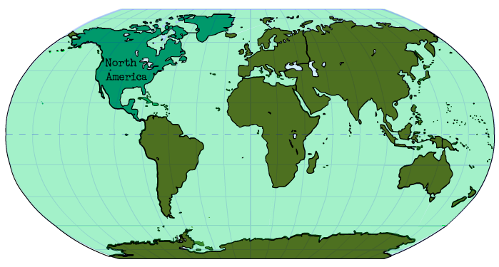
North America is the third largest continent and is located entirely within the Northern Hemisphere and almost all within the Western Hemisphere. The major countries of North America are Canada, the United States, and Mexico.
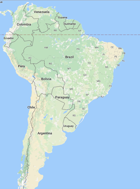
South America
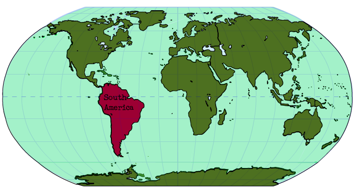
South America is a continent located entirely in the Western Hemisphere and mostly in the Southern Hemisphere that is connected to North America by the Isthmus of Panama. The Isthmus of Panama is a narrow strip of land that lies between the Caribbean Sea and the Pacific Ocean, linking North and South America. The major countries of South America are Argentina, Brazil, Chile, Peru, Columbia, and Venezuela.
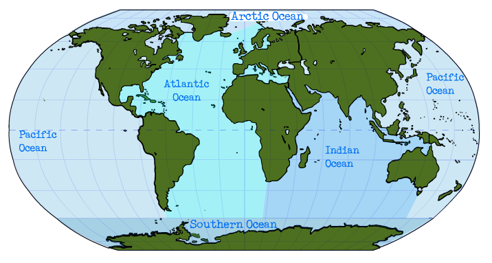
The Major Oceans of the World
The major oceans of the world are the Indian Ocean, the Arctic Ocean, the Atlantic Ocean, the Pacific Ocean, and the Southern Ocean.
The Major OceansOver three fourths of the Earth's surface is covered by water.
|
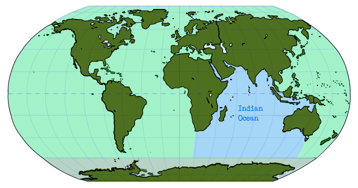
The Indian OceanThe Indian Ocean is located on Africa's eastern border, Asia's southern border, and Australia's eastern border.
|
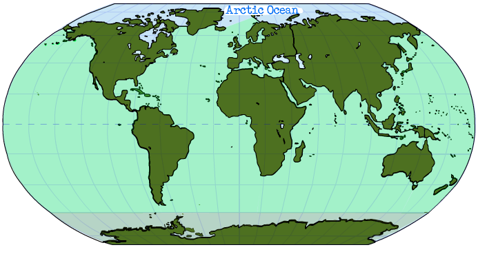
The Arctic OceanThe Arctic Ocean surrounds the North Pole and is the Northern most ocean.
|
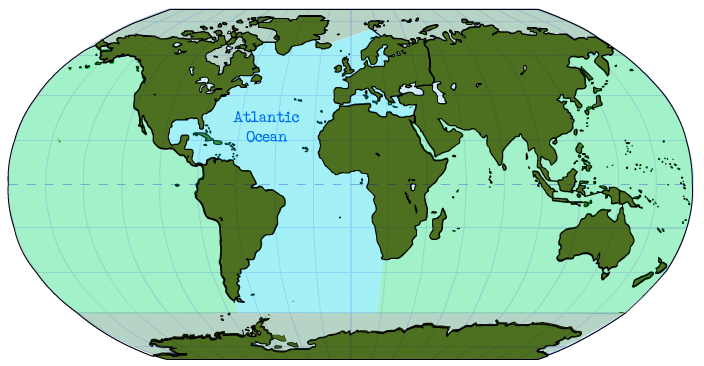
The Atlantic OceanThe Atlantic Ocean is the ocean on North and South America's eastern border and Europe and Africa's western border.
|
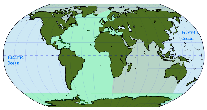
The Pacific OceanThe Pacific Ocean is located on Asia and Australia's eastern border and North and South America's western border.
|
The Southern OceanThe Southern Ocean surrounds the South Pole and is the Southern most ocean.
|
PRACTICE IT!
Activity 3: Use the maps above to label and color the maps in your Lesson Chronicles on the Lesson 1 Political Maps Page found under the header "Lesson Maps."
APPLY IT!
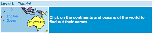
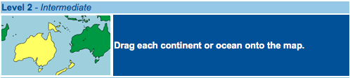
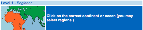
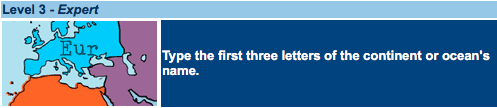
Activity 4: Apply what you learned about political maps by clicking on the icons below and playing the Continents and Oceans Map games. Start with the Tutorial. Then move to Level 1 - Beginner, Level 2 - Intermediate, and finally Level 3 - Expert. You may practice with these at home too!
|
|
MISSION ACCOMPLISHED!
Did you accomplish your mission for this Lesson? Are you able to say the following I can statements?
- I can define the term, "political map."
- I can identify the seven major continents and five major oceans.
- I can identify the major countries of each continent.
Activity 5: Click on the icons below to test yourself. Each test has 3 modes: practice, test, and strict test. Hover over the Question Mark by each one to learn about each quiz option. Practice as many times as you like.
LESSON COMPLETE!

You have completed Lesson 1 - Political Maps. Click on the button below to go back to the Topic 1 - Geography 101 Homepage.